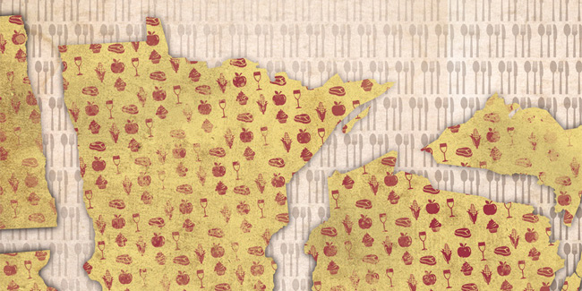
This excerpt from The Secret Atlas of North Coast Food is sponsored by Save The Boundary Waters, which was organized by local residents in and around Ely, Minnesota, who are dedicated to protecting the more than one million acres of pristine water, unspoiled forests, and abundant fish in the Boundary Waters Canoe Area Wilderness and its watershed from toxic pollution caused by mining copper, nickel, and other metals from sulfide-bearing ore.
Into The Pines And Over The Fire: Epic Wilderness Meals In The Boundary Waters Canoe Area And Beyond
by Alyssa Vance
Excerpted from The Secret Atlas of North Coast Food
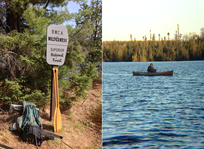
Way up in the northeastern corner of Minnesota, nestled next to the Canadian border and tucked within the Superior National Forest, sits more than one million acres of pristine wilderness. The Boundary Waters Canoe Area (BWCA) is guarded by the U.S. National Forest Service and is one of the most coveted hiking, camping, and canoeing regions in the country. It is dense with thousands of lakes and waterways that were formed millennia ago when the glaciers that originally covered the region began to retreat, leaving behind a region sprinkled with pine, water, and bedrock. There are more than 2,000 campsites in the BWCA alone — and that doesn’t take into account the popular surrounding camping destinations like Grand Marais, Ely, and the Lake Superior shoreline.
Spending any time in wilderness demands work. And in this region the work is earned by portaging canoes, strapping on backpacks, and traveling by foot or water for long — and often strenuous — stretches, over land and water. However with this work comes reward. And don’t the best rewards come in the form of food?
Below is a collective narrative of memorable wilderness meals in northern Minnesota. It begins by the rock-laden Lake Superior shore, travels north and west through the still waterways and thick pines of the BWCA, and trails off at International Falls along the Canadian border.
—
Highway 61 is a road adjacent to the Superior Hiking Trail — a 296 mile stretch that follows the Lake Superior shorelines and connects Duluth to the Canadian border. Silver Bay is a small town on that highway, roughly 50 miles north of Duluth. If you turn inland when you reach it, you’ll have access to a hilly three-mile hike that leads you away from the sprawling Lake Superior shoreline, into a walkable roller coaster of rocky hills, and arrives at two bodies of water: Bean and Bear Lake.
“We hiked the trail in early July. The air was thick with heat and humidity, and most of the trail was spent under a blanket of trees. You’re constantly take long steps to hike up or gingerly walking on a downward slope. As a novice hiker, it was challenging. But all worth it when we reached the peak that juts out over Bean Lake — a crisp, quiet, bright blue lake in the middle of all these trees. We camped at Bear Lake, just beyond it. We used our tiny camping stove to heat a hearty curry soup with coconut milk, sliced chorizo sausage, carrots, and lentils. Dessert was a sweet, crunchy muesli square. Eating both while staring out at this peaceful lake was one of the most satisfying moments of that summer.” — Alyssa Vance, Minneapolis
—
George H. Crosby Manitou State Park sits 20 miles northeast of Bean and Bear Lake. The land was donated by its namesake, the mining magnate George H. Crosby. It boasts more than 3,000 acres of backpack-only camping grounds — an effort to preserve as much untouched nature as possible. The Manitou River cuts through the park and eventually spills into the chilly Lake Superior water.
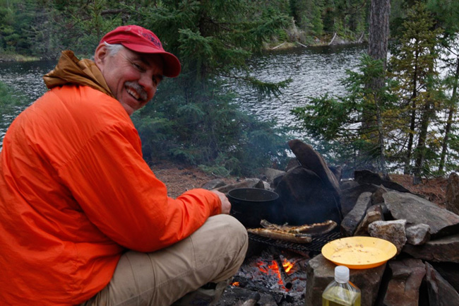
“The day after we arrived, we took a seven-hour hike down the river and back up the Cedar Ridge Trail, coming back to camp via the Humpback Trail. One of the best hikes of my life thanks to the constantly changing scenery and the beautiful cascades on the river, but probably among the more exhausting. Coming back to camp, we realized that we are all several steps beyond starving. So we devised an improvised dinner plan based on what we had: Wisconsin-made summer sausage, a lot of Fraboni’s bacon grease in our skillet, a couple large bags of add-water-and-heat potato soup. First thing we did was cube the summer sausage and fry it over the campfire in bacon grease. Then we got an enormous pot of soup going, which we fortified with the slightly crispy, bacon-boosted summer sausage. I don’t think there’s any way this kind of cooking could carry over into the everyday modern world, but after burning piles of calories on the trail, and in the cool of night by the fire, it was one of the richest, creamiest, most satisfying things I’ve ever eaten.” — James Norton, Minneapolis
—
Kawishiwi Lake is a three-mile shot straight north of George H. Crosby Manitou State Park. Because it sits on the southeastern edge of BWCA border it’s considered an accessible entry point for a portage. It’s also an irregularly shaped lake — so there is a surprisingly long shoreline and plenty of small bays. The head of the Kawishiwi River sits on the north side of that lake. If you head towards it and hike north for seven-plus miles you’ll eventually meet with Malberg Lake — a 400-ace body of water accessible only via canoe.
“The best food I’ve ever had in the BWCA was a delicious meal of breaded northern pike and smallmouth bass, lightly fried with chicken-of-the-woods mushrooms and ostrich fern fiddleheads that we foraged. We didn’t have breading, so we slowly toasted some rye bread we had until it was crumbly, and coated the fish prior to frying in some grape seed oil someone had. It really tasted of the North Woods.” — Matthew Kumka, Minneapolis
—

Saganaga Lake is 20 miles northeast of Malberg Lake, and is cut in half by the Canadian border. At more than 13,000 acres, it’s the largest body of water within the BWCA. Sea Gull Lake is just south of Saganaga Lake. The nearly 5,000 acres of water are dotted with more than a hundred small islands and surrounded with pine and granite cliffs.
“The first time I visited the BWCA was with my dad when I was five-years-old. I started to go annually after that, through high school, and eventually worked at a canoe outfitter during my college summers. I made a lot of “hobo dinners” — a bunch of potatoes, meat, butter, and veggies in foil and tossed directly over the fire. We also made a version of apple pie. We pressed pre-made apple filling between two slices of bread and put it in a press over the fire. We picked berries, too. There was a lot of burnt forest area up there and it was blueberry heaven. There are a lot of beauties that come after a fire, and one of those is berries.” — Sarah Kaiser-Schatzlein, Minneapolis
—
Neglige Lake is a relatively small and narrow body of water about 15 miles south of Sea Gull Lake. It’s considered one of the more remote lakes, since it’s difficult to access and has just one campsite. Because it is an operating fishery, the water is flush with two species of trout: brook and rainbow.
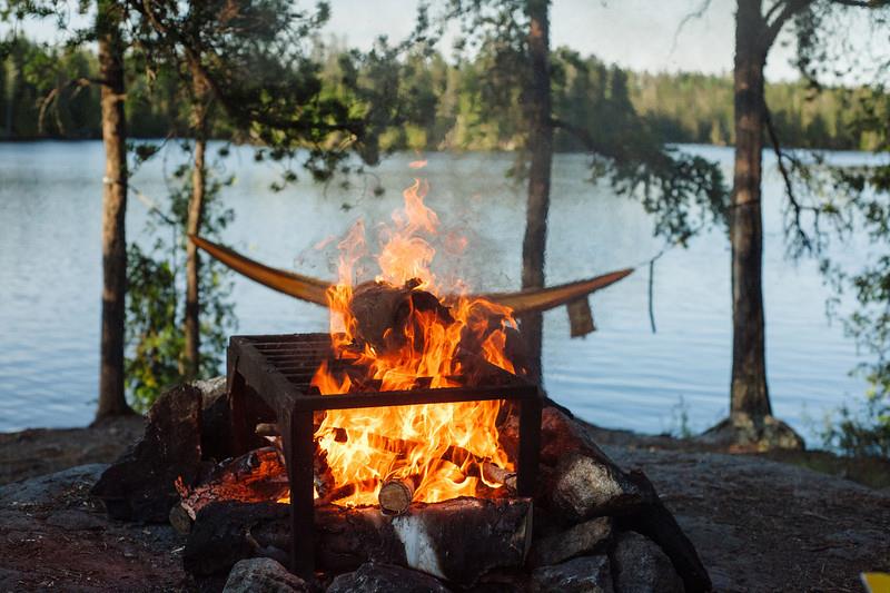
“It was our first time in the BWCA. We took turns carrying the canoe. I was on duty during the last portage to Neglige Lake. We bulldozed through about a mile of underbrush. It was hot out, and pretty challenging. When we finally got to the lake it was early evening and there were fish jumping out of it. We caught about 10 to 12 brook trout, then gathered these big, flat stones, and heated them over a fire for about an hour.* We put the fish – whole – in foil with butter and spices. It tasted like a more tender piece of salmon. Oily, flavorful meat. The meat pulled right off the bone.” — Chris O’Brien, Minneapolis
—
Angleworm Lake is roughly 30 miles east of Neglige Lake. It’s a long, thin body of water. Much like the shape of … a worm. To get to it, campers hike along the Echo Trail — 14 miles long and filled with red and white pine and scenic overlooks.
“Four of us portaged two miles from Echo Trail to Angleworm Lake. We were carrying a 23 foot, 4-person canoe! We had stopped at Fitger’s Brewhouse on our way up and filled up a few Nalgene growlers of beer. Our first campsite dinner was pizza: chicken, walnut, caramelized onion, garlic, pesto. We grilled the chicken and caramelized the onions before we left, carried the dough in a gallon-size plastic bag, and just added water and yeast before we cooked them on the cast-iron skillet.” — Jeremy Nelson, Minneapolis
—
The town of Ely is 13 miles south of Angleworm Lake. It’s considered one of the gateway cities to the BWCA. Like many towns along the Iron Range, the first economies were influenced heavily by logging and mining. International Falls is over 100 miles northwest of Ely — right at the Canadian border.
“We took a 68-day-long canoe trip from Ely to Canada for our honeymoon. Along the trail, there was this amazing series of lakes with narrow waterways that had been cleared. We romanticized that they had been maintained for centuries. One lake was crystal clear blue, and we could dive down 20 feet and see one another. I spent about a month or two dehydrating food to prepare for the trip. I had never had fish tacos, and I wanted to make them. We fished almost every day and caught northern, walleyes, and the obligatory brook trout. I made my own tortillas on the trail and used dehydrated tomatoes, cheese, and dried beans. Life was so simple: paddle, eat, sleep.” — Andrea Strom, Ely